Weather patterns around the world are influenced by many natural climate systems, but few are as well-known or as impactful as El Niño and La Niña. These two climate patterns, collectively known as the El Niño-Southern Oscillation, or ENSO, influence weather across the globe, affecting everything from rainfall and drought to hurricane activity and winter storms.
Although El Niño and La Niña are frequently mentioned in seasonal forecasts, many people are unsure what they arEl Niño vs La Niña: 7 Critical Differences Explained
Weather patterns around the world are influenced by many natural climate systems, but few are as widely recognized as El Niño vs La Niña. These two climate patterns are part of the El Niño–Southern Oscillation, commonly known as ENSO.
El Niño and La Niña begin in the tropical Pacific Ocean, but their effects can reach communities around the world. They influence rainfall, drought, temperatures, winter storms, agriculture, and hurricane activity.
Although both terms frequently appear in seasonal forecasts, many people are unsure how they differ. Here are seven critical differences between El Niño and La Niña and an explanation of which phase is currently active.
What Is ENSO?
ENSO is a naturally occurring climate pattern involving changes in ocean temperatures, winds, rainfall, and atmospheric pressure across the tropical Pacific Ocean.
It has three phases:
-
- El Niño
-
- La Niña
-
- ENSO-neutral
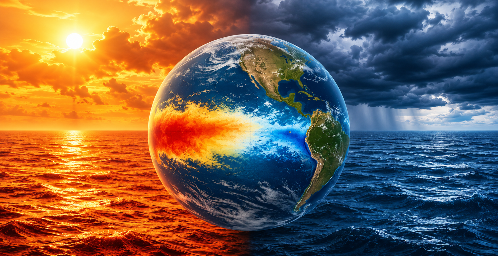
El Niño represents the warmer phase, while La Niña represents the cooler phase. ENSO-neutral occurs when ocean and atmospheric conditions do not meet the requirements for either El Niño or La Niña.
These phases shift irregularly, generally every two to seven years. Although ENSO develops in the Pacific, it can disrupt normal weather patterns in distant regions. NOAA describes El Niño and La Niña as the warm and cool phases of this recurring ocean-atmosphere pattern.
What Is El Niño?
El Niño occurs when sea-surface temperatures in the central and eastern tropical Pacific become warmer than average and the atmosphere responds to that warming.
El Niño is often associated with:
-
- Weaker trade winds
-
- Wetter conditions in parts of the southern United States
-
- Drier conditions in Australia and Indonesia
-
- Milder winters in portions of North America
-
- Reduced Atlantic hurricane activity
-
- Greater tropical cyclone activity in parts of the eastern Pacific
El Niño often suppresses Atlantic hurricane development because it tends to increase vertical wind shear. Strong wind shear can interfere with a tropical system’s ability to organize and strengthen. However, damaging hurricanes can still occur during an El Niño year.
What Is La Niña?
La Niña is the cooler phase of ENSO. During La Niña, sea-surface temperatures across the central and eastern tropical Pacific become cooler than average.
La Niña is often associated with:
-
- Stronger trade winds
-
- Wetter conditions in Australia and parts of Southeast Asia
-
- Drier weather in portions of the southern United States
-
- Cooler winters in parts of North America
-
- Increased Atlantic hurricane activity
-
- Reduced rainfall in certain areas of South America
La Niña can support Atlantic hurricane development because it is commonly associated with lower vertical wind shear. Its actual effects still depend on the location, season, strength of the event, and other atmospheric conditions.
El Niño vs La Niña: 7 Critical Differences
The main El Niño vs La Niña differences include:
| El Niño | La Niña |
|---|---|
| Warmer tropical Pacific waters | Cooler tropical Pacific waters |
| Generally weaker trade winds | Generally stronger trade winds |
| More rain in the central or eastern tropical Pacific | Less rain in the central tropical Pacific |
| Often suppresses Atlantic hurricanes | Often favors Atlantic hurricane activity |
| Can bring wetter weather to some regions | Can bring drier weather to some regions |
| Often raises short-term global temperatures | Can temporarily reduce some surface warming |
| Shifts global circulation one way | Shifts circulation in the opposite direction |
Although their effects differ, both phases are natural parts of Earth’s climate system.
Are We Currently in El Niño or La Niña?
As of July 2026, El Niño conditions are present.
NOAA’s Climate Prediction Center reported on July 9, 2026, that El Niño was continuing and expected to strengthen through the end of the year. NOAA also reported a 97% probability that it would persist through early spring 2027.
This does not mean every region will experience typical El Niño conditions. ENSO changes the likelihood of certain seasonal patterns, but it cannot predict an individual hurricane, flood, drought, or heat wave.
The current phase may change over time, so this section should be reviewed against NOAA’s monthly ENSO Diagnostic Discussion whenever the article is updated.
How Do El Niño and La Niña Affect Global Weather?
The effects of El Niño vs La Niña vary by region and season. Depending on the active phase, different communities may face an increased likelihood of:
-
- Heavy rainfall and flooding
-
- Drought
-
- Heat waves
-
- Wildfire conditions
-
- Stronger winter storms
-
- Changes in tropical cyclone activity
-
- Disruptions to agricultural growing seasons
Meteorologists monitor Pacific Ocean temperatures, rainfall, trade winds, and atmospheric pressure to identify the current phase. This information improves seasonal forecasting, but it does not provide an exact daily weather forecast.
Do El Niño and La Niña Cause Climate Change?
No. El Niño and La Niña are naturally occurring climate cycles. Climate change refers to long-term changes in Earth’s climate system.
However, ENSO can temporarily influence global temperatures and rainfall. El Niño can contribute to unusually warm global periods, while La Niña may temporarily reduce some surface warming. These short-term variations do not replace or reverse long-term climate trends.
Why Understanding El Niño vs La Niña Matters
Understanding El Niño vs La Niña helps people interpret seasonal forecasts and prepare for changing weather risks.
ENSO forecasts can support planning related to:
-
- Agriculture
-
- Water management
-
- Hurricane preparedness
-
- Energy demand
-
- Transportation
-
- Emergency response
While ENSO cannot predict individual events, it provides useful insight into the broader conditions that may become more likely during a season.
Final Thoughts
El Niño and La Niña begin in the tropical Pacific, but their influence extends around the world. These natural climate patterns can affect rainfall, drought, hurricane activity, snowfall, temperatures, and agriculture.
The key El Niño vs La Niña distinction is that El Niño involves warmer tropical Pacific waters, while La Niña involves cooler waters. As of July 2026, El Niño is the active phase and is expected to strengthen through the remainder of the year.
Understanding these differences can make seasonal forecasts easier to interpret and help communities prepare for changing weather conditions.
Frequently Asked Questions
Is El Niño warmer than La Niña?
Yes. El Niño involves warmer-than-average sea-surface temperatures in the central and eastern tropical Pacific. La Niña involves cooler-than-average temperatures in the same general region.
Which phase causes more Atlantic hurricanes?
La Niña generally creates more favorable conditions for Atlantic hurricanes because it is commonly associated with lower vertical wind shear. El Niño often suppresses Atlantic activity by increasing wind shear.
How often do El Niño and La Niña occur?
El Niño and La Niña occur irregularly, generally every two to seven years. Their duration and strength vary.
Are we currently experiencing El Niño or La Niña?
As of July 2026, El Niño conditions are present. NOAA expects the event to strengthen through the end of 2026 and likely continue into early 2027.
Sources
-
- National Oceanic and Atmospheric Administration (NOAA) Climate.gov. What Is ENSO? Available at: https://www.climate.gov/enso
-
- NOAA Climate Prediction Center. ENSO Diagnostic Discussion (July 2026). Available at: https://www.cpc.ncep.noaa.gov/products/analysis_monitoring/enso_advisory/ensodisc.shtml
-
- NOAA National Centers for Environmental Information (NCEI). ENSO Monitoring. Available at: https://www.ncei.noaa.gov/access/monitoring/enso/
-
- National Aeronautics and Space Administration (NASA) Earth Observatory. El Niño and La Niña. Available at: https://earthobservatory.nasa.gov/features/ElNino
- World Meteorological Organization (WMO). El Niño / La Niña Updates. Available at: https://wmo.int/topics/el-nino-la-nina